Thursday 10 July 2014

Lesson Ideas - Thinking Out Loud....

Globular Clusters and Big Bang Theory

Analogy for explaining distribution of globular clusters – place our galaxy in a glass sphere such that the diameter of the galaxy is the same as the diameter of the sphere. The clusters would be placed around the galaxy, with greatest number towards the centre and reducing further from the centre. This helps to support the Big Bang Theory. Whereby matter has begun in the centre of the universe and is moving outward. Could this be easily made by students as a 3D model? What could we use to model this? 


Statistical Analysis using Rocks and Site Mapping

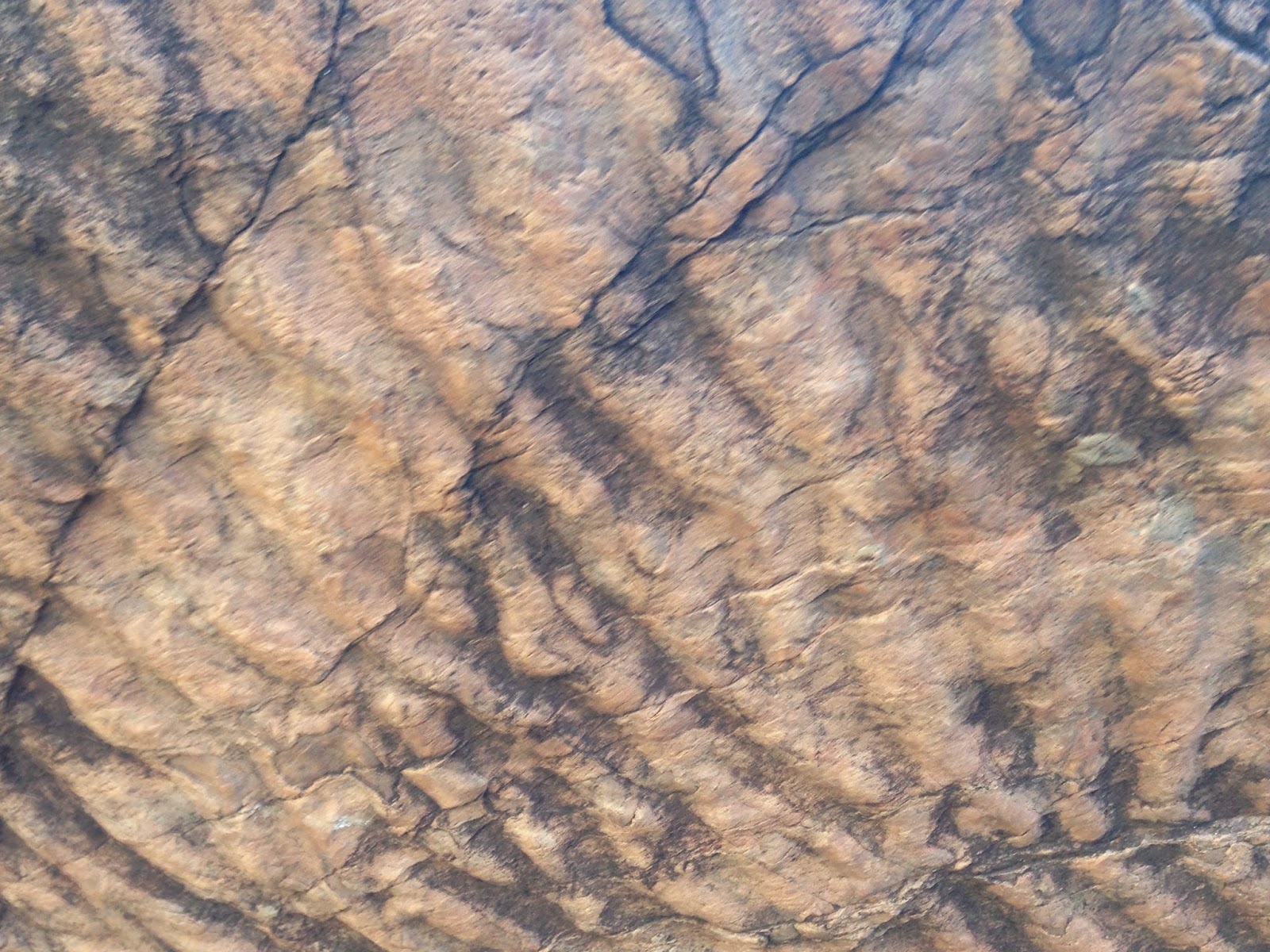
Simulation of Mars Desert Research Station study site. Obtain samples that are representative of the two distinct areas at the study site (volcanic rock forms and rounded pebbles that would be representative of an oceanic setting). Most schools have collections of volcanic rock and the teacher may then opt to use pebbles that could be purchased from a gardening store or pet shop etc.

Provide students with numerous samples, maybe 100 rocks. Have students classify these rocks and complete a statistical analysis. They might be simply identifying the colour of the rocks, their shape and their size. Other more advanced might be able to identify what types of rocks are in the sample. This provides an opportunity to complete cross-curricular tasks and develop skills in numeracy through Geology.

The same rocks could also be intentionally/deliberately placed for identification by student “rovers”.

Site Mapping
Have one student describe to another student what the region looks like in greatest detail possible. Second student draws the described landscape, including the colours visible. Students then develop an explanation of the combination of rocks randomly selected at this location.

OR

Have students study what they see in the panoramic shot of the selected study site.

Rover Testing


Have students develop and complete standardised tests based on those completed during the expedition on RC vehicles or I-Spy wi-fi controlled vehicles. Following these standardised tests experiment with the vehicles (teacher only) to assess capability of vehicle for modification of suspension etc if this is a possibility provide students with information to assist them to complete simple supervised modifications on vehicles. Retest vehicles and suggest whether their suitability as rovers has improved with the modification.

Day 5 - EVAs continue and Rovers Complete Speed Tests


https://www.youtube.com/watch?v=Aee16g4BjMw&feature=youtu.be


Wednesday 9 July 2014

Day 4 - EVA for Spacesuits and Rover Testing

Affect of Spacesuits on Rock Identification 


Today a few activities ran simultaneously with the geology team keen to test what impact wearing the Spacesuit helmets had on the ability of Geologists and non-Geology trained astronauts to identify stromatolite formations. When completing general tests in previous days there had been comments that the helmets of the spacesuits had a considerable impact on the vision and perception of those wearing them. One of the palaeontologists had concerns that she would not be able to identify significant forms with the helmet on and she also hypothesised that she may miss geological and fossilised forms altogether.  The tests were conducted by sending individuals through an area identified by Jon Clarke has containing stromatolites. Each individual completed the walk twice, once with the helmet and then once without. The impact that this had on their accuracy in identifying stromatolites was recorded by Jon as he followed them along the selected pathway.


While these 8 tests were conducted the UNSW had the opportunity to test their rover in a flat area near the Arkaroola air field.


Tuesday 8 July 2014

Day 3 - More EVAs and First Rover Test Site

The following link and photos show the test ramps for the standardised rover tests being constructed.


EVAs

The first EVA conducted was the make modifications to the weather station located at the observatory overlooking Arkaroola Village. I will have footage of this EVA as it becomes available. There was no UAV support during this EVA, only radio support and communication between astronauts and mission control. 


Astronauts and UAV prior to the EVA. This EVA did not involve any contact with additional personnel only the UAV and radio contact was used to support the crew. The UAV was used to direct the crew to areas of interest. The geologist watched the UAV display in the hilux to ask the astronauts to make more specific observations. The UAV needed to change batteries 3 times due to the additional strain provided by the high wind conditions. A mobile phone was also attached to the base of the UAV to provide ongoing GPS information.

UAV

ABC journalist Eloise in a Spacesuit

After the EVA....
https://www.youtube.com/watch?v=3JFsquKPFPE&feature=youtu.be


Day 2 - First EVAs

Extra-Vehicular Activity


Tasks that are aimed at simulating the tasks they would need to be completed beyond the confines of a vehicle or habitat on the Moon, Mars or International Space Station.

These simulations are aiming to provide researchers with an insight into the way individuals on the mission respond to different stimulus throughout the simulated activity. On the mission photographed below the "astronauts" were given a set of specific instructions to follow that included collecting rock samples. The instructions were given via radio by a geologist who, in this EVA, followed the astronauts. The unmanned aerial vehicle (UAV or drone) was used to document the EVA, but also to direct the astronauts to observe objects of interest that the astronauts were within range of.

Screen display from UAV camera

UAV controller

 Geologist, Jon Clarke, Astronauts, Rover and UAV during the EVA.

Rover, Astronauts and UAV

Today was also an opportunity for me to learn about the standardised tests being conducted by Murdoch University on the Rovers that have been brought to Arkaroola. The standardised tests were developed by the National Institute for Standards and Technology in the United States. These tests are usually used to on emergency response rovers and include tests that aim to determine how well the rovers travel over uneven ground, how much weight they can pull on a sled and how well their cameras are able to focus on specific points. The standardised tests are the first of their kind and were only released for use in April this year. This will be one of the first times they are used. Each standardised test includes specific instructions on how to set up each test and what equipment must be used. The tests are designed to provide an accurate comparison of vehicles despite differing locations and environments. Graham, from Murdoch University, as developed additional standardised tests to provide feedback on the suitability of these rovers for space exploration purposes. He has developed a test which requires the rovers to find a missing astronaut and deliver a means of communication.. He has also a test that is designed to test the rovers over very rocky terrain, such as that located on Mars. This makes Arkaroola the ideal test area! I would like to talk to my students about these standardised tests and the efforts taken to control variables.

http://www.nist.gov/el/isd/ms/robottestmethods.cfm

Each of the participating rover teams were required to give specific information on their rover. This information is used for data collection and statistical analysis purposes as well as to assist in future classification of the rovers. The data collected included the weight and dimensions of the rover, type of battery, type and number of cameras, number of wheels, types of senses on the rover and the program used to operate the rover.

The rovers present are from the UNSW, Murdoch University, Mars Society of Australia and the Mars Society of India.

Sunday 6 July 2014

Day 1 - Field Trip to Geological Sites of Significance


Day 1 - Field Trip to Geological Sites of Significance


Videos to be added to blog at a future date

The above photo is the location that has been selected as the site for an Australian Mars Desert Research Station. The geology of the site is really interesting, the left hand side of the photo had rocks that depicted an ocean environment, where as those on the right hand side of the photo show evidence of a lava flow.

This area would be a great site as it is appropriately isolated (such that test subjects would not have contact with the outside world during isolation trials), is on basalt (found on Mars), has immediate access to a variety of environments (including gorge country and plains) to ensure that test subjects have close proximity to different terrain to test instruments/spacesuits etc


This photo is me with

Swainsona formosa (Sturt's Desert Pea)


The next photo shows a type of cyanobacteria that is able to grow in quite an extreme environment. These types of cyanobacteria are called hyperliths (when they are on the outside) and endoliths (when they are on the inside). This cyanobacteria is actually photosynthesising through the rock and was of great interest to the astrobiologists from NASA during the last Spaceward Bound Expedition in 2009. Extremophiles are of great interest to astrobiologists, who seek to establish an understanding of the genetic make-up of such life forms such that they will be identified if sampled as extinct forms on Mars. Mars Rovers also need to be able to identify the molecular components of these forms as well as seek out such forms in their unusual habitats.


The second stop was at Stubbs Water Hole, there were large conglomerate rocks that provide evidence that there was once a glacier through this area. Being able to recognise such evidence is key to studying the geology on Mars. Similar geological formations on Mars would indicate glacial activity in the past.


Bararrana Gorge was the next stop, here we were able to observe waves in the rocks (photos below). The different wave formations provide evidence that these were once ocean shallows of varying depths. Similar forms on Mars would indicate the presence of shallow water.


The photo to the right shows us the evidence that there was once significant salt content. The salt leaves angular indentations in the rock, due to its lattice structure.

A large piece of ochre! Please go to the following link for more information on ochre from my NSW Premiers Teacher Scholarship and lesson ideas! http://nswptsnhilton.blogspot.com.au/2014/02/day-twenty-nine.html


Analysis of veins such as those in the photo to the right may have been caused by primitive microbial life forms. When studied under a microscope there appear to be bean-like structures that are representative of a bacterial film. Studies are still being completed to confirm the link between these vein structures and the presence of primitive fossilised forms.


The photo to the left shows dendritic formations on rocks, these are pseudo-fossils caused by oxidation and reduction under very specific environmental conditions. The formation of these shapes on the rock would have happened at a depth of less than 4 metres in the presence of water. The formations themselves are caused by the oxidation of manganese as it comes into contact with water rising through the sedimentary rock. These formations hold great relevance to the study of Mars as their presence does indicate the presence of water not too far below the planet's surface. There have also been studies completed that indicate that there shape is influenced by the presence of microbes, just as above.

The photograph to the right shows a stromatolite formation. The picture is actually on its side, with the tops of the stromatolites pointing towards the right.
Lesson ideas for incorporating Mars Exploration can be located in my Google Drive at:

https://drive.google.com/folderview?id=0B0vhEt79wAtuVEYxYklucmVQT1k&usp=sharing